Creating Geospatial Tables in the ProjectWise Database
By default, when both the ProjectWise Geospatial Management extension to ProjectWise Design Integration Server and ProjectWise Geospatial Administrator are installed and you create a new datasource, geospatial tables are automatically created in the database.
For an existing datasource, you will be prompted to create geospatial tables in the database the first time you log in to the datasource in ProjectWise Geospatial Administrator:
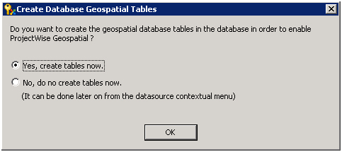
You can either select Yes to create the database tables now, or No if want to create them later or not at all. If you choose not to create them when prompted, you will still be permitted to log in and use the datasource. (This is a change from previous versions, where you had to create the geospatial tables in the database in order to log in.)
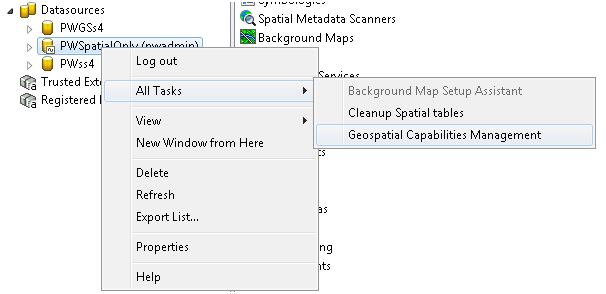
If you select No when prompted to create the database tables, you can create them later by right-clicking the datasource and selecting All Tasks > Geospatial Capabilities Management:
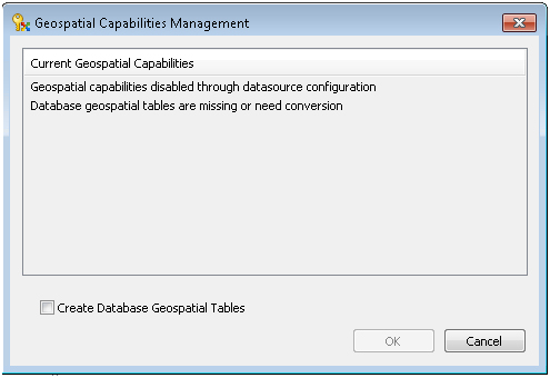
Next, the Geospatial Capabilities Management dialog opens and displays the current state of the datasource, that is, whether or not ProjectWise Geospatial is enabled in this datasource and whether or not the database has the required geospatial database tables. Assuming that ProjectWise Geospatial is not enabled yet, select Create Database Geospatial Tables and click OK.